
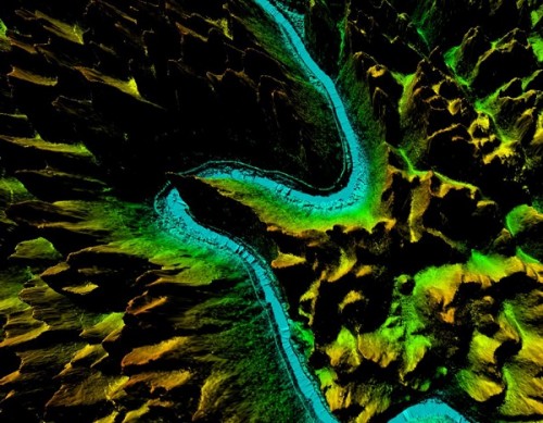
Digital Elevation Model (DEM) is a digital representation of the topography of a terrain or surface, created through a combination of ground surveying techniques and remote sensing technologies such as LiDAR (Light Detection and Ranging) and radar. DEMs are generated from variably-spaced Lidar ground points, or they can be created using a raster grid. The DEM is essentially a 3D digital model of the surface, which includes the elevation data for each point on the surface.
DEM data is stored in a raster format, with each cell or pixel of the raster representing a specific location on the surface and its corresponding elevation. DEM data can be used for a variety of applications, including terrain analysis, hydrological modeling, urban planning, and visualization of landscapes.
The accuracy of the DEM depends on the resolution of the data used to create it, as well as the processing techniques used to interpolate the elevation data. Higher resolution data and more advanced interpolation techniques generally result in more accurate DEMs.
DEM data is commonly used in GIS (Geographic Information Systems) and other mapping applications, where it can be combined with other types of spatial data to create detailed visualizations and analysis of the terrain. Get More Details
Specifications of DEM Digital Elevation Model Processing
Resolution: ≥3 points/m²
Project area: 39,090 km²
Duration: 1 month
Output: DEM, DSM,classified point clouds
Application: Forestry planning
Accuracy: ≥98%
Grid spacing: 2m
From: Guangxi Forestry Bureau

EDTA ACID $ 0.00

FIBERGL ASSTELE $ 20.00

0.96 INCH TFT DI $ 100.00

1.0mm Implants a $ 125.00

100 GSM Fast Dry $ 100.00
| Comment | ||
| Comment on the content: | ||
| Enter verification code: |
|
|