
Product details
3D Mapping
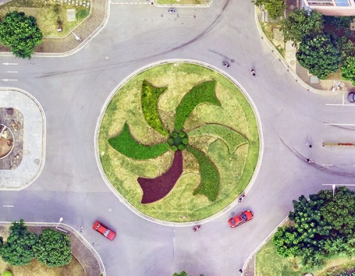

Product details
3D Geospatial Data Processing
Resolution: 5cm
Project area: 220km²
Duration: 11 months
Output: 3D model
Application: Urban planning
From: Wuxi Municipal Bureau of Land and Resources
Application of 3D Geospatial Data Processing
â—† Transportation Network
â—† Water, Sewage Pipelines
â—† Natural & artificial drainage
â—† Land use plans
â—† Segregation of conflicting land uses
â—† Urban Design
â—† Landscaping
â—† Urban Morphology
â—† Green & open spaces
â—† Mass & void maps
Feiyan Technology would like to offer you high efficiency 3D Geospatial Data Processing with self-developed processing software and high processing accuracy. We will be your close partner on land planning and management. Contact us to get solution on 3D data processing.
Same type of products
More...
EDTA ACID $ 0.00
FIBERGL ASSTELE $ 20.00
0.96 INCH TFT DI $ 100.00

1.0mm Implants a $ 125.00

100 GSM Fast Dry $ 100.00
| Comment | ||
| Comment on the content: | ||
| Enter verification code: |
|
|